
Multnomah Falls Access Restricted For A Year During Unprecedented Highway Closure
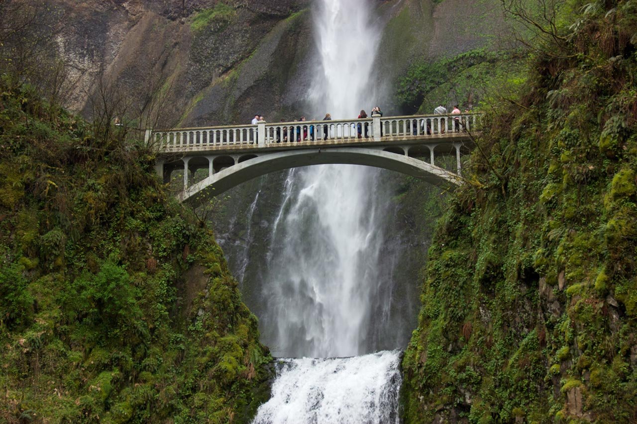
Access to Multnomah Falls is one of the side effects of the closure of parts of the historic Columbia River Highway as it undergoes reconstruction between 2024 and 2026. The elevated highway or west viaduct- between Wahkeena Falls and Multnomah Falls, will be closed until Memorial Day 2025.
Limited Access To Multnomah Falls Following Highway Reconstruction Work
The Oregon Department of Transport (DOT) confirmed that repairs on the west viaduct will start on October 1. As a result, a section of the Historic Columbia River Highway/U.S. 30 will be closed.
Part of a broader effort to restore the century-old Historic Columbia River Highway viaducts, the planned repairs include resurfacing the road, restoring columns and railings, and reinforcing the structure to maintain its historical integrity.
The highway carries around 4,000 vehicles daily and is listed as a National Historic Landmark. On completion of the west viaduct, the project will shift to the east viaduct. The latter will close from October 2025 to Memorial Day 2026 with periodic lane closures and flaggers to direct traffic.
During construction on the west viaduct, eastbound vehicles on the highway will be unable to access Multnomah Falls. Traffic will be rerouted at Wahkeena Falls Trailhead. Westbound vehicles can travel as far as Multnomah Falls Lodge where they will be rerouted.
Multnomah Falls Lodge and nearby trails remain open during the highway closure and can be accessed by taking public transportation or parking in the Interstate 84 lot at Exit 31.
Bus services, including Columbia Area Transit (CAT) and Ready Set Gorge, offer routes to the falls. Updates on road closure and real-time traffic updates, parking availability, and detour information are available online at available on TripCheck.